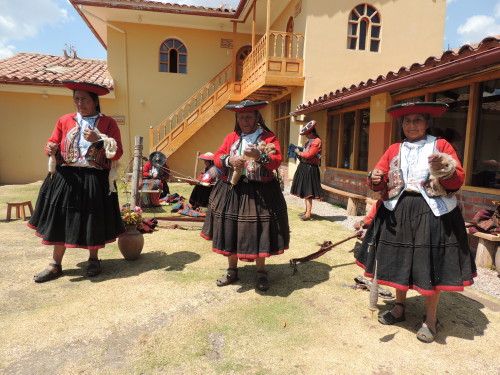
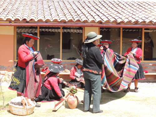
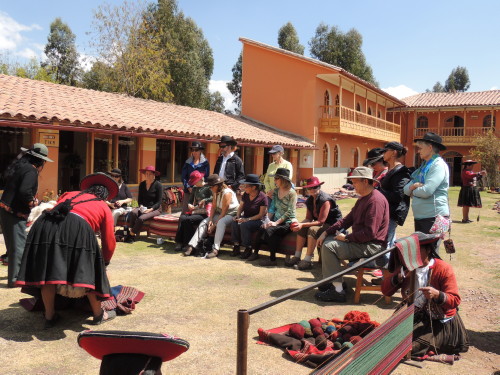
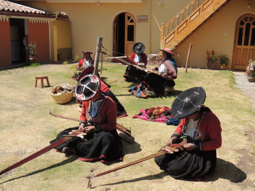
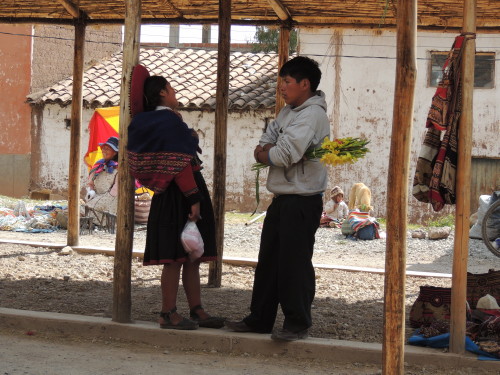
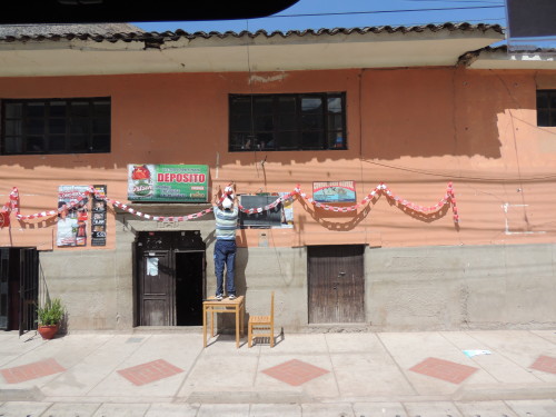
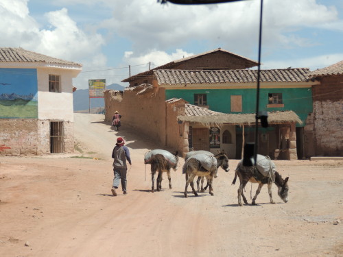
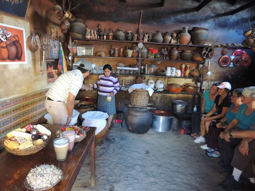
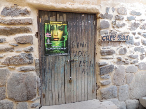
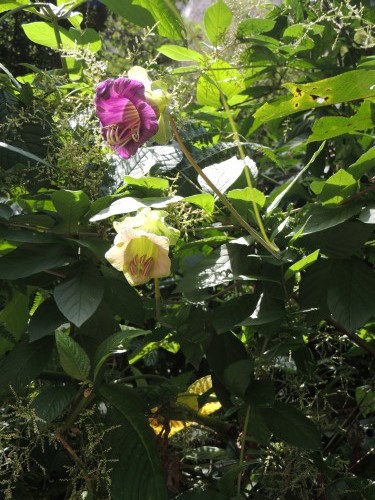
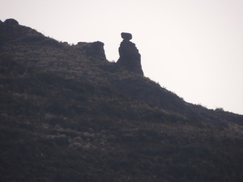
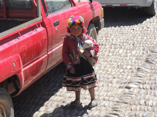
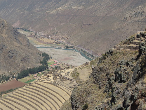
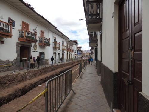
Chinchero
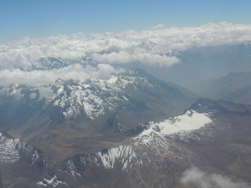
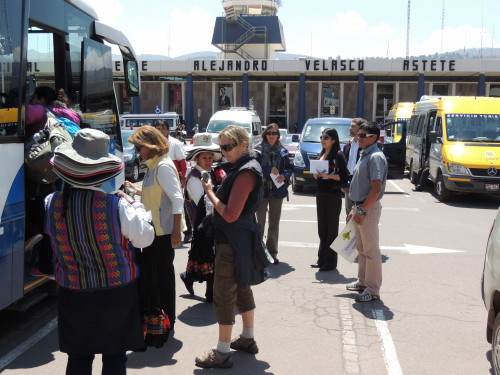
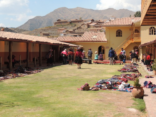
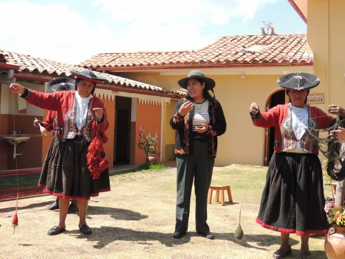
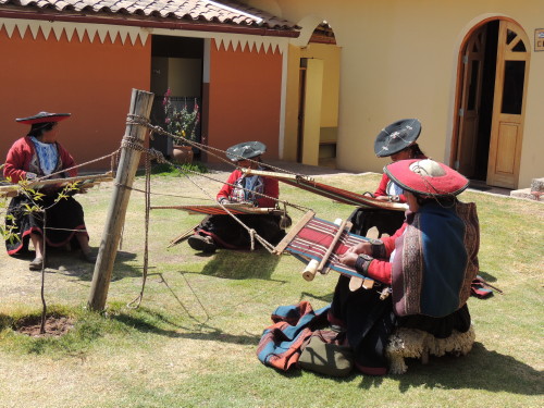
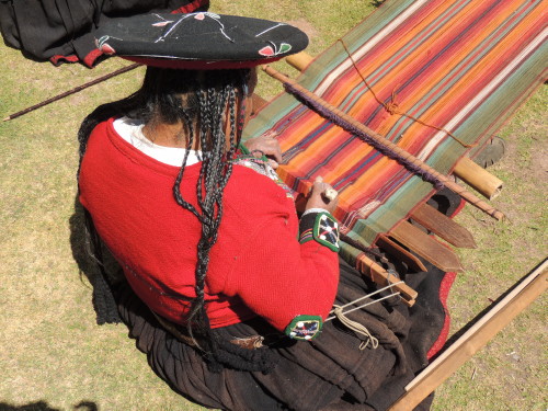
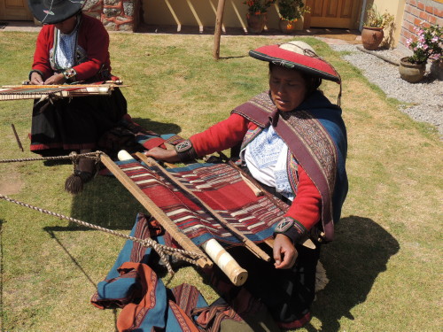
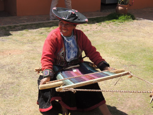
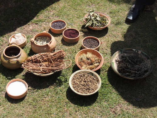
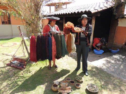
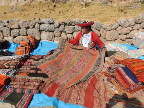
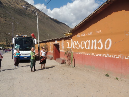
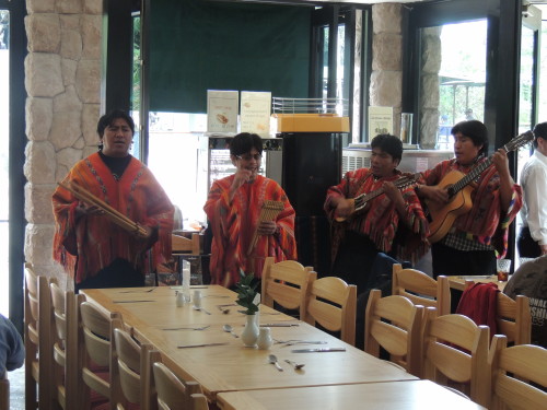
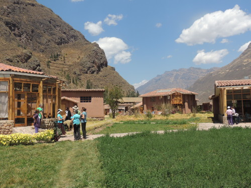
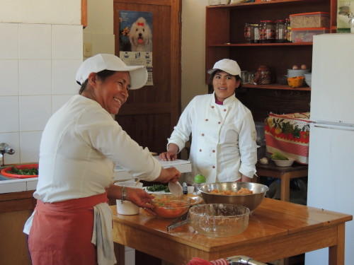
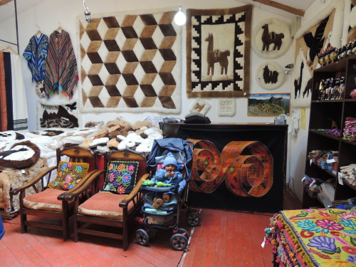
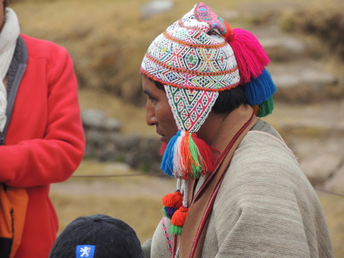
To get to the Sacred Valley I flew from Lima, on the west coast of Peru, to Cusco, in southeastern Peru. From there, I traveled by bus for about an hour to Chinchero, a small Andean village just 28 km (17 mi) away. The first stop was the Center for Weavers of Chinchero (Centro de Tejedoras Chinchero; Awayricch' arichiq). Chinchero, the "birthplace of the rainbow", as it was known by the Incas, has a community of women weavers. Here, Quechua-speaking women demonstrated traditional Andean textile weaving techniques and the making of natural dyes using plants, insects (cochineal) and minerals. Plant diversity is high in the Andes and the use of the native flora by the Andean people is varied and vast. Plants are used for dying wool, food, medicines, crafts, construction, and commerce. Some of the plants used for making natural dyes include quico, qolle, molle, nogal, ch'illca, awaypili, tara, indigo and lichen. Since the late 1970's, Chinchero weavers have promoted the preservation of Peruvian Inca textiles and weaving traditions by making hand woven goods. Textiles in the village of Chinchero are woven on backstrap looms using natural fibers (i.e., sheep, alpaca and llama wool) and natural dyes. And, you can purchase textile goods from the women who make them and help the local economy. The Chinchero weavers are members of the Center for Traditional Textiles of Cusco. The Center works with nine regional communities to preserve unique ancestral techniques and patterns in their textiles. The Center’s purpose is to help preserve and celebrate Andean textiles, improve the economy of the weaving communities by selling quality textile goods and assist weavers in carrying on a tradition practiced for more than 2000 years.
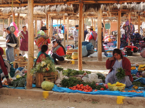
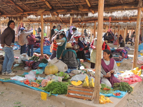
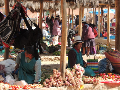
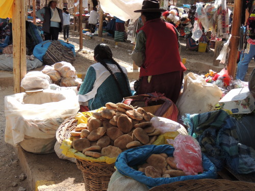
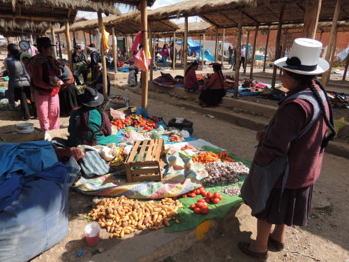
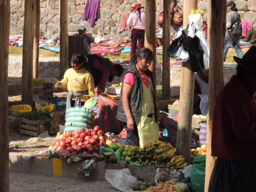
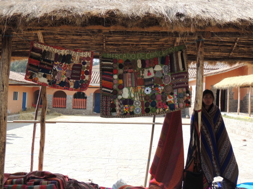
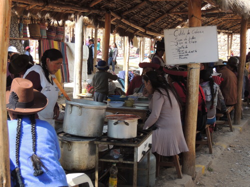
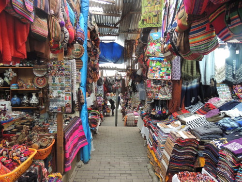
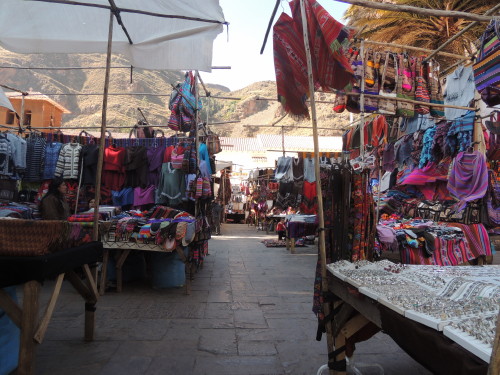
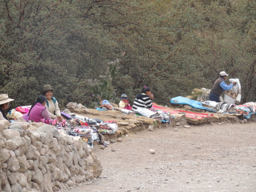
The next stop was the crafts market in the main square of Chinchero. It was Sunday and the market was really bustling. The market offers all sorts of handicrafts, woolen craft goods including arpilliras (charming appliqués, created by women and children from scraps of cloth, depicting scenes of village life), and local fruits and vegetables from the valley. The colorful sights, sounds, and smells of the market still linger with me today.
Click on image for slideshow and captions
Urubamba and Maras
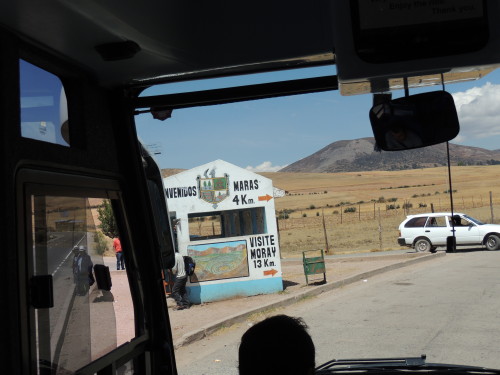
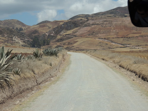
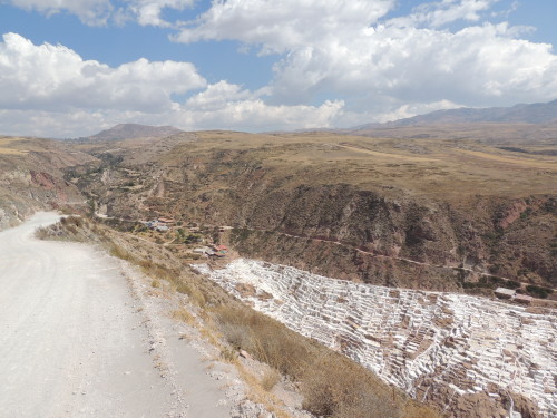
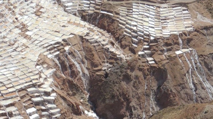
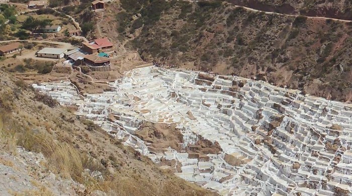
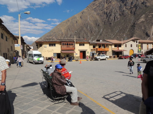
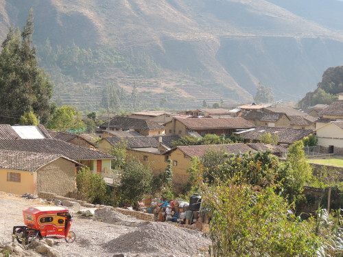
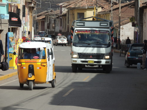
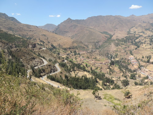
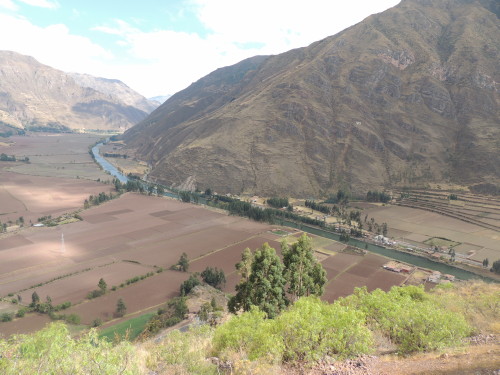
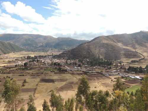
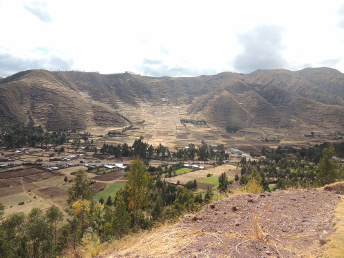
From Chinchero, my next stop was Urubamba. The town is located in the heart of the Sacred Valley alongside the Urubamba River and was one of the main agricultural centers of the Inca Empire. Located 57 km (35 mi) northwest of Cusco down the Chinchero route, Urubamba is the largest town in the Sacred Valley with a population of some 25,000 people. Nearby is the small town of Maras. From Maras we were headed to the Moray archaeological site and the salt-pans of Salinas.
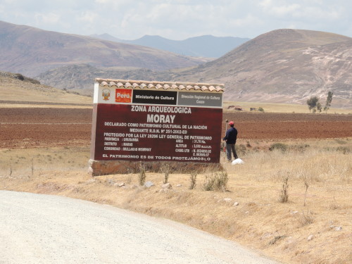
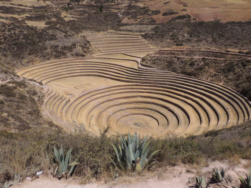
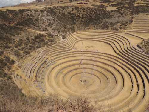
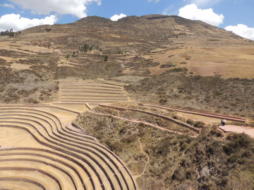
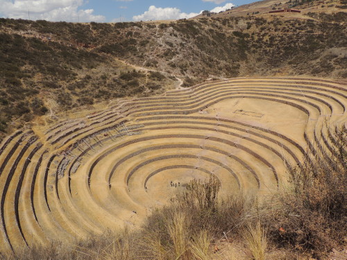
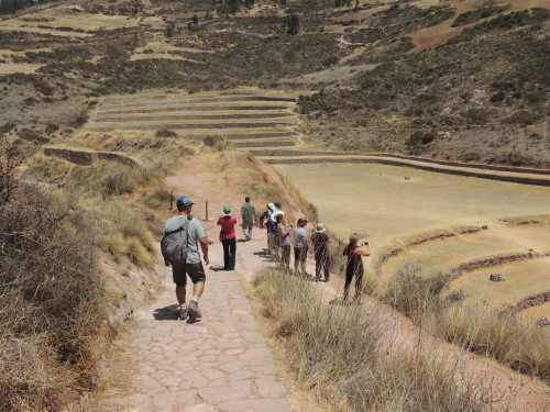
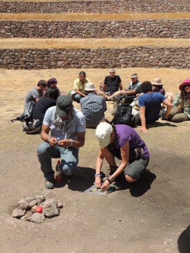
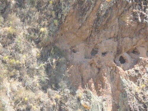
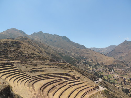
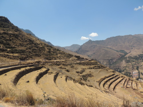
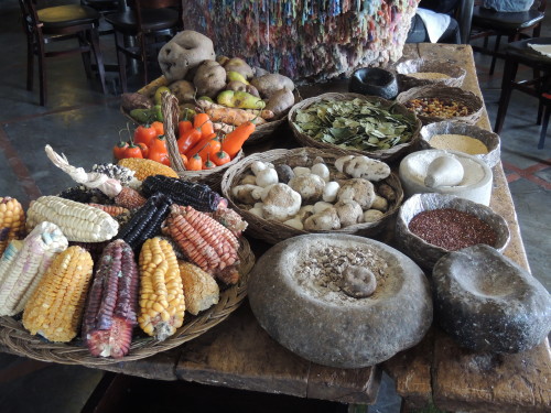
Moray is a group of deep, gigantic, bowl-like natural depressions in the earth in which concentric, circular stone terraces were carved into the landscape by the Inca. The series of circular platforms are deep and wide. They descend down to some 150 m (492 ft) and measure about the same in width. The terracing, a series of irrigation channels and the discovery of different seeds on the terraces have led scientists to believe that Moray was once an Inca crop lab. Many think the site was used by the Inca to cultivate resistant and hearty varieties of plants high in the Andes. The Incas planted wheat, quinoa, panti, kantu flowers (Cantua buxifolia, the Peruvian national flower), corn and some 4,000 varieties of potatoes at Moray and experimented with different elevations/altitudes, sunlight exposures and temperatures within the terraced depressions. Definitely one of the coolest agricultural labs I've ever seen.
The salt-pans of Salinas reportedly consist of some 5,700 salt collection pools. I wonder who counted them all. About 600 years ago, the Inca discovered a natural salt water spring in the valley. They channeled the spring water into thousands of pools where the water evaporates and leaves crystallized salt to be harvested. The pools each yield about 150 kilos of unrefined salt per month. The Cusco & Machu Picchu Moon Handbook notes this is the salt exported and marketed as "Peruvian pink salt".
Click on image for slideshow and captions


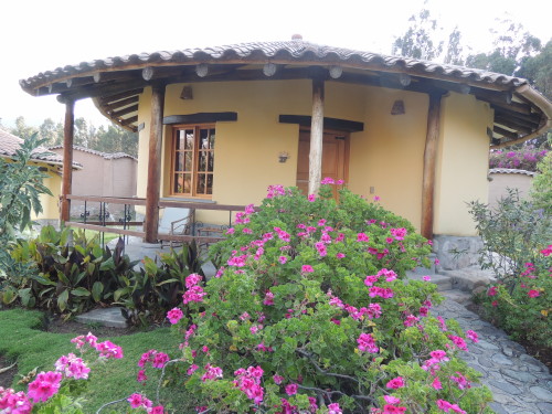
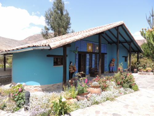
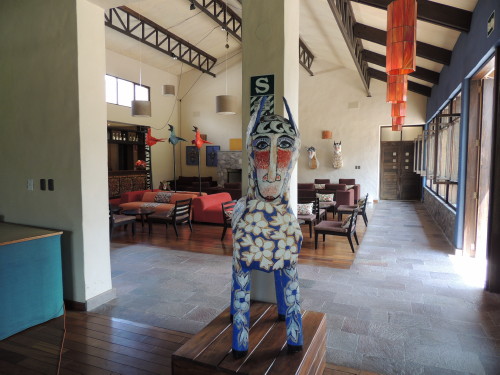
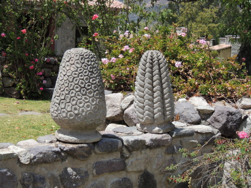
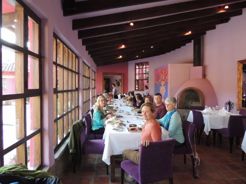
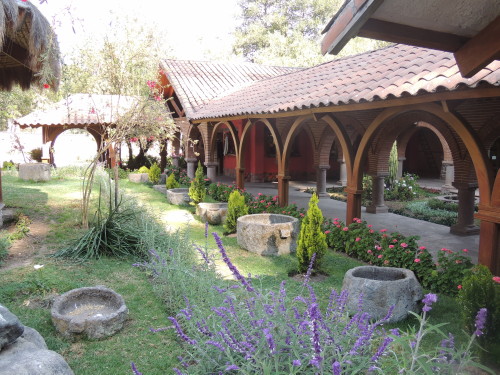
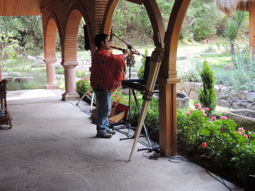
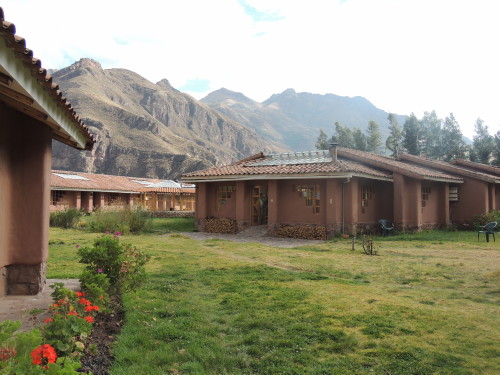
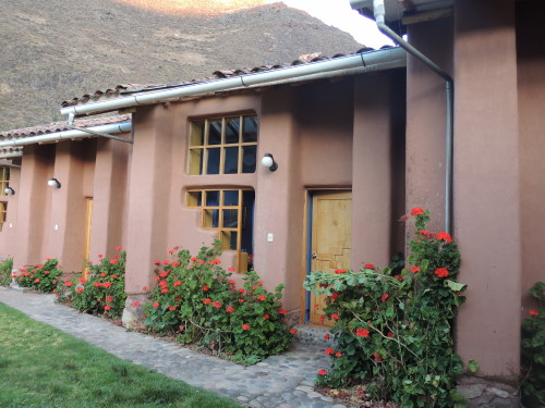
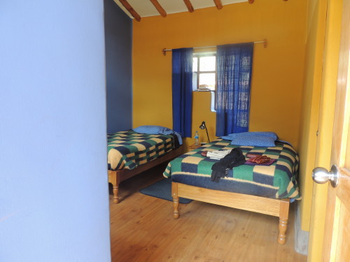
Sol y Luna & Yucay
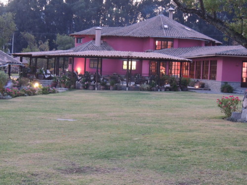
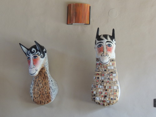
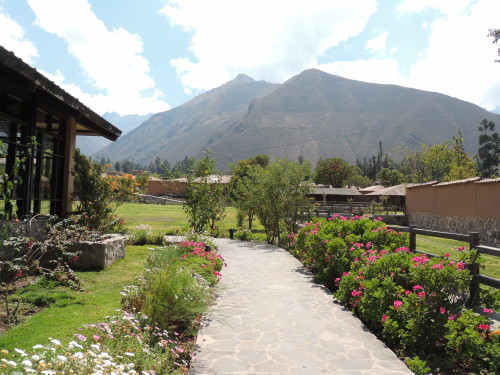
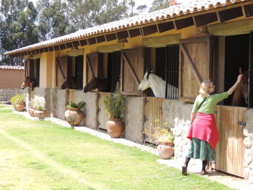
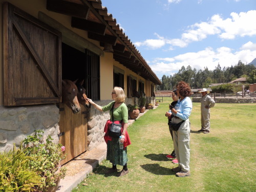
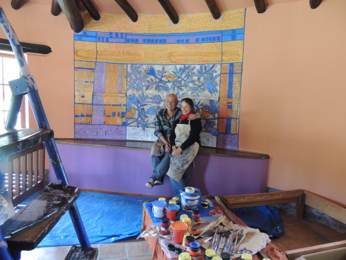
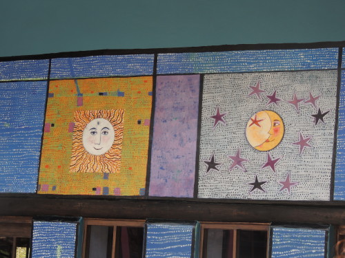
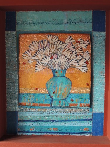
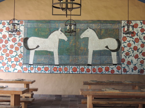
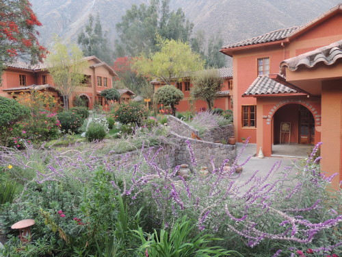
Hotel Sol y Luna in Urubamba, Peru, includes casitas, gardens, indoor and outdoor dining, spas, and stables in the back which lodge Peruvian horses (caballo de paso). While there, I met artists Federico Bauer and Francisca del Campo whose artwork is featured at the hotel. This place is a quiet fusion of Andean landscape, culture and art.
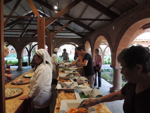
In Yucay, we feasted on a lunch buffet at Sonesta Posadas del Inca, a former 18th century colonial-style monastery.
Click on image for slideshow and captions

Ollantaytambo
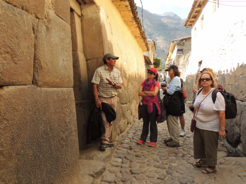
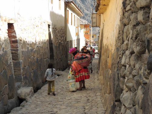
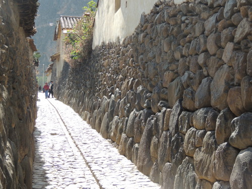
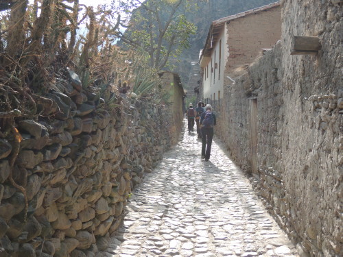
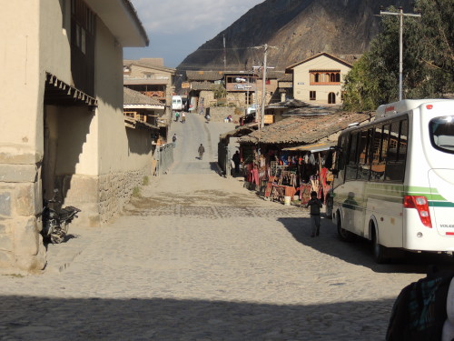
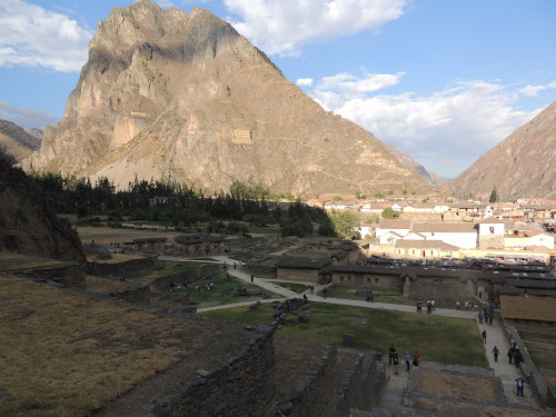
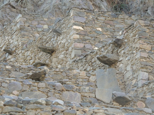
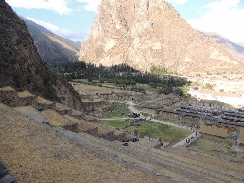
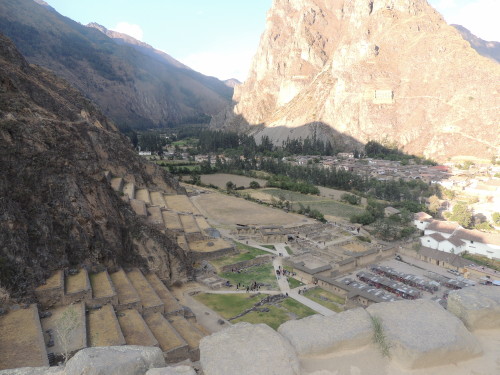
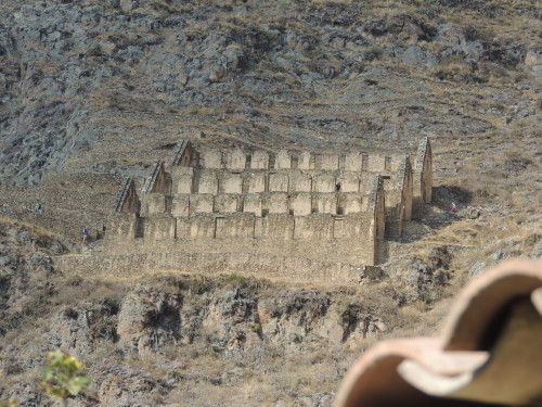
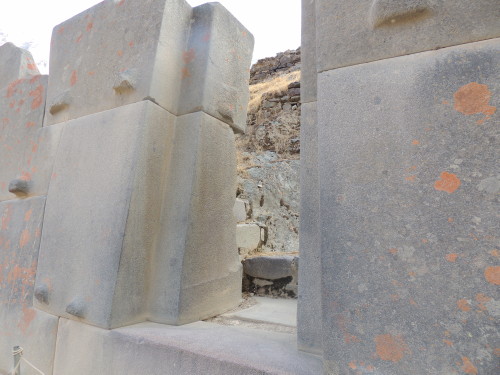
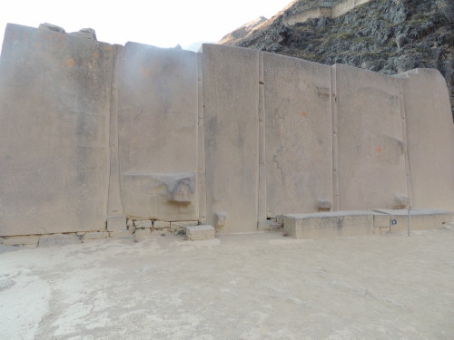
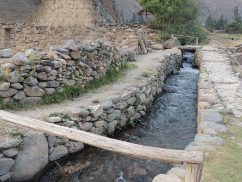
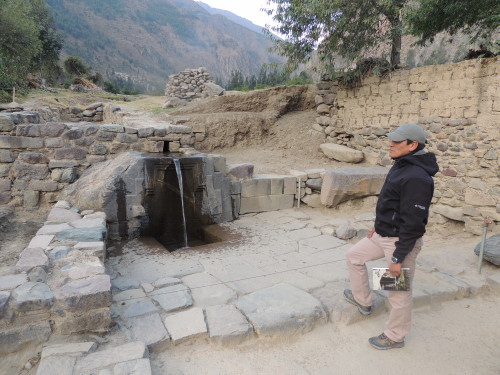
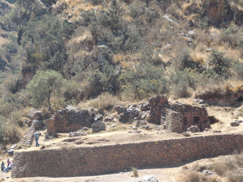
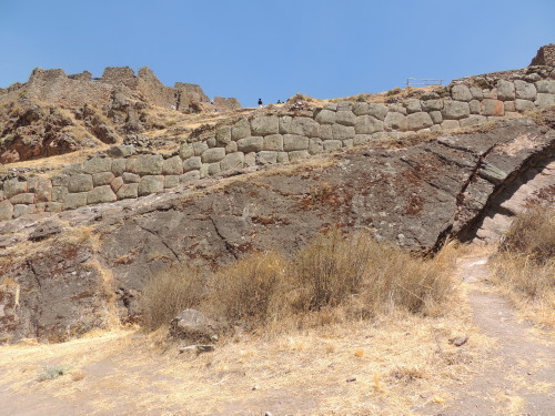
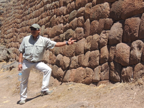
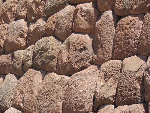
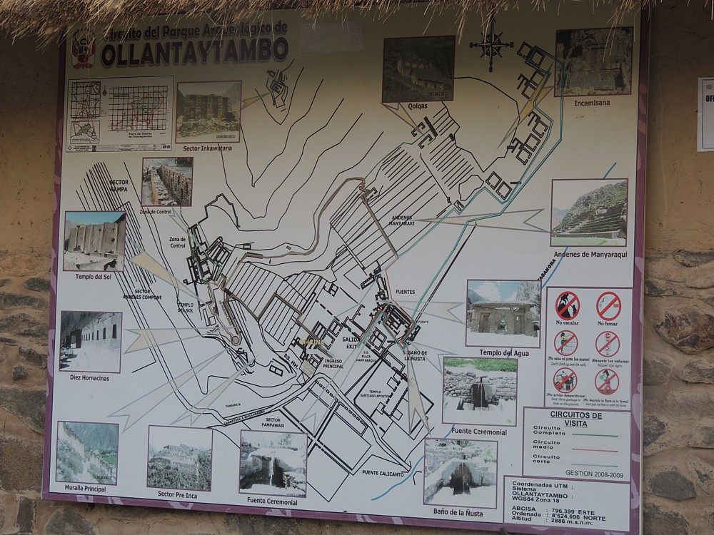 Ollantaytambo is a small Quechuan town located at the western end of the Sacred Valley some 89 km (55 mi) northwest from Cusco. Local people call this city Ollanta in honor of General Ollanta, the Head General for Inca King Pachacuti. Homes and buildings are built on top of original Inca stone foundations, and the town is described as being among the best-preserved Inca villages in Peru. The town itself is located at the foot of some steep terracing which leads up a mountain and to Inca-era archeological ruins. I made the stiff hike to the Temple of the Sun. The ruins includes residential areas, temples, platforms, storehouses (colcas) and others enclosures whose purpose is sketchy. The ruins are called a fortress but our guide called it an Inca ceremonial center. With the arrival of the Spanish in the 1500's, the complex was converted by the Incas from a ceremonial center into a fortress to protect the strategic entrance to the lower Urubamba Valley. Monolithic granite blocks used for this complex were hauled out from the Cachicata quarry more than 8 km (5 mi) away. This quarry is high up on the mountainside way over on the opposite side of the Urubamba River. How the Inca moved and shaped these stones and built Ollantaytambo is unknown. The construction of this site was never completed. Although Ollantaytambo eventually fell into the hands of the Spanish it is the only Inca stronghold ever to have defeated the Spanish army.
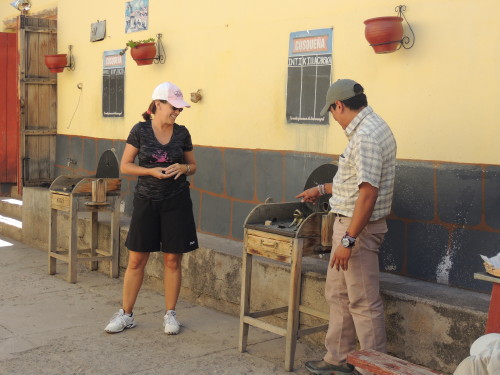
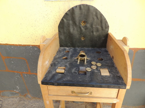
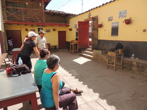
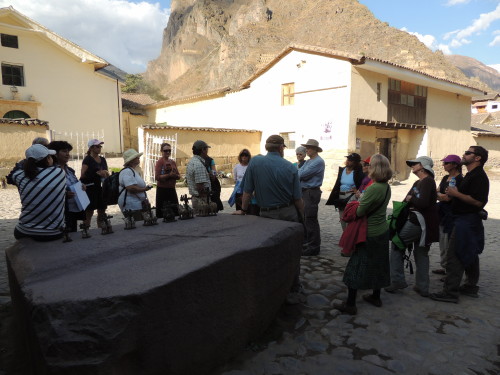
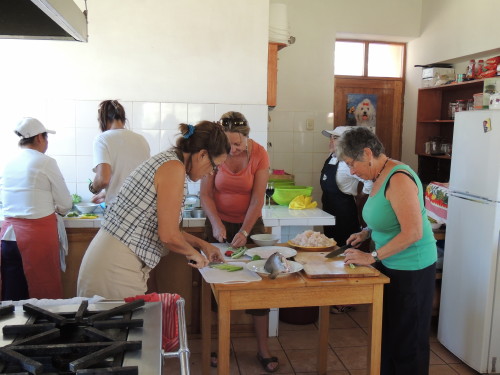
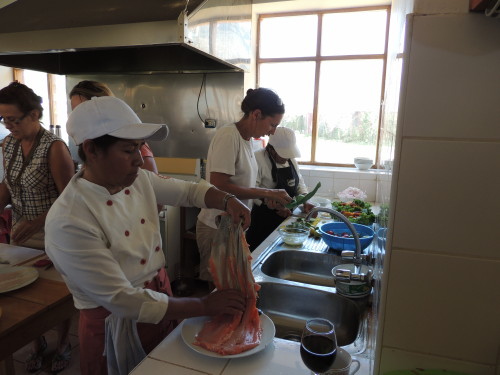
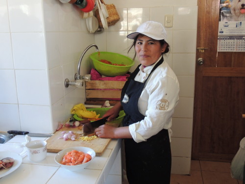
On the way to the ruin site we stopped at a chincheria or fermented maize drink shop and were treated to a chicha making demonstration. Chicha is a homemade fermented drink made from maize, manioc root (also called yucca or cassava), grape, apple, strawberries or various other fruits. It is fermented just by leaving out in room temperature, covered with cheesecloth.
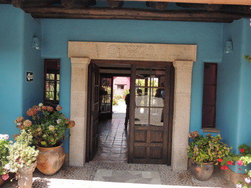
Accommodations: Hotel Pakaritampu; Tasty Dining: Hotel Pakaritampu
Click on image for slideshow and captions


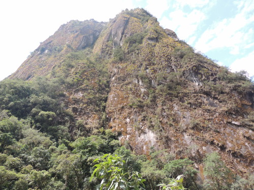
Aguas Calientes
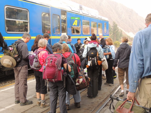
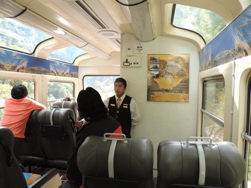
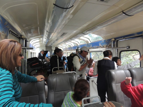
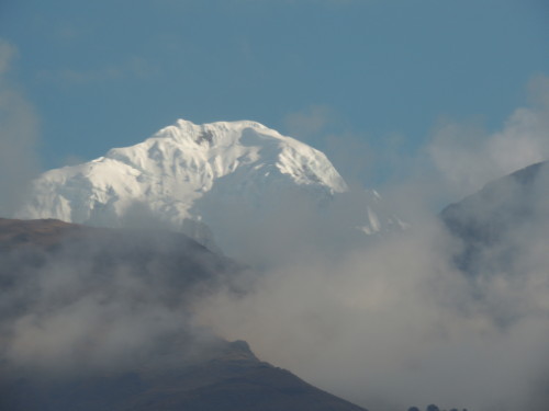
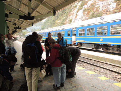
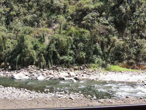
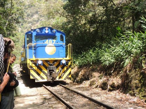
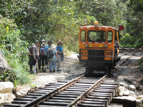
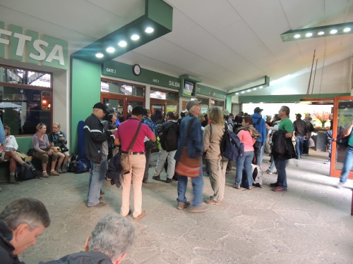
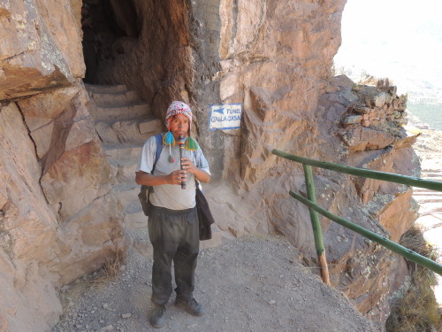
From Ollantaytambo, I took a morning PeruRail Vistadome train to Aguas Calientes. The trip was a scenic 1.5 hour journey. The Vistadome coach has large panoramic windows that perfectly frame fleeting scenic landscapes of snow-topped mountains and villages. Gazing out the window, I felt like a travel film maker at work. The piped-in Andean music fitted in nicely as the soundtrack to the film.
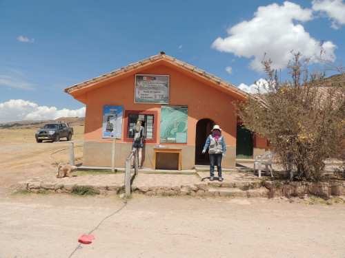
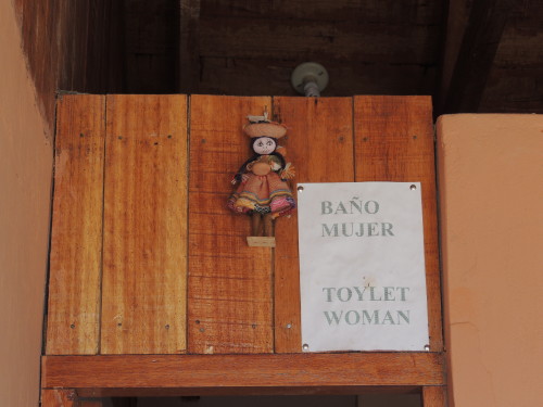
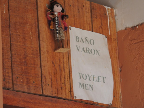
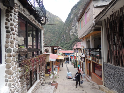
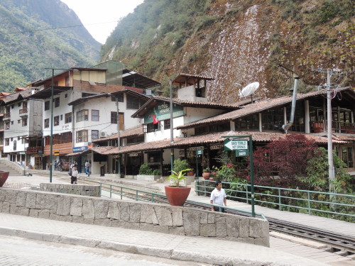
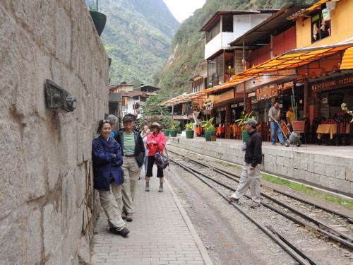
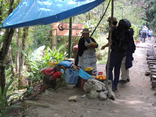
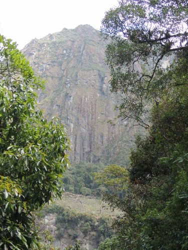
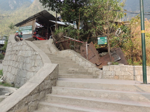
Aguas Calientes is a busy little town located on the banks of the Aguas Calientes and Urubamba Rivers and surrounded by steep mountains. This place is quite the transportation hub. It is the nearest town and main access point to the Machu Picchu archeological site and its train station (Puente Ruinas Station) is the end of the line for the PeruRail train to the ruins. That's why hundreds of tourists arrive here everyday. From Aguas Calientes, buses shuttle tourists to the ruins though most backpackers seem to opt for the two to three hour ascent on foot.
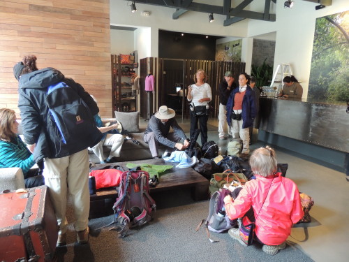
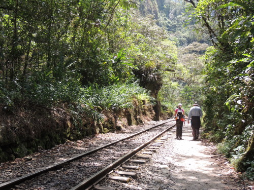
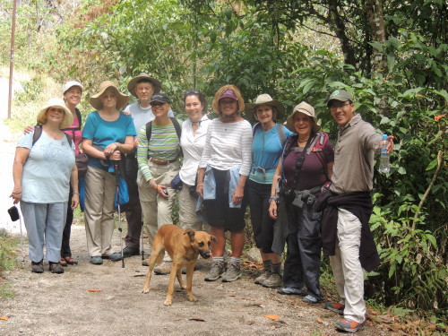
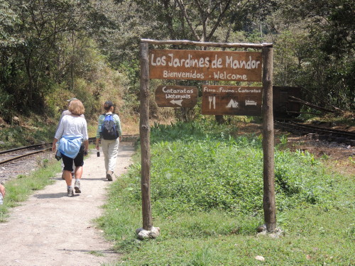
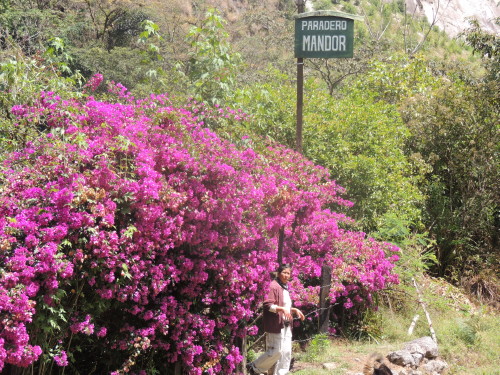
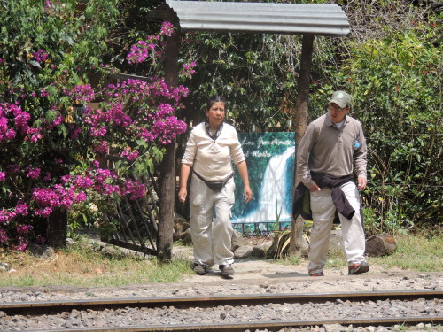
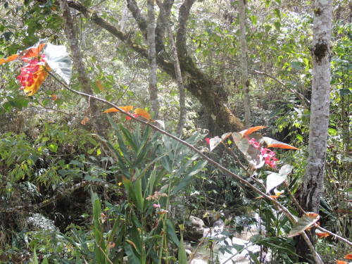
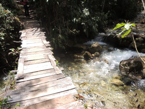
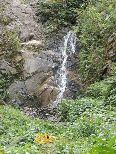
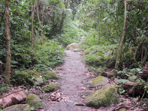
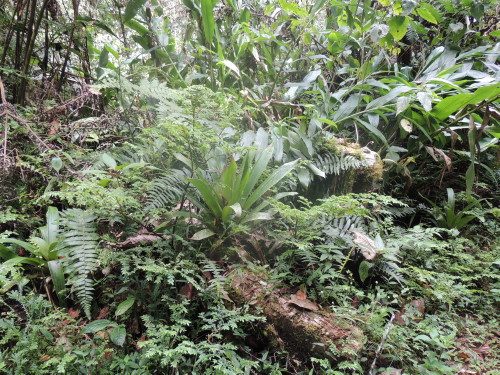
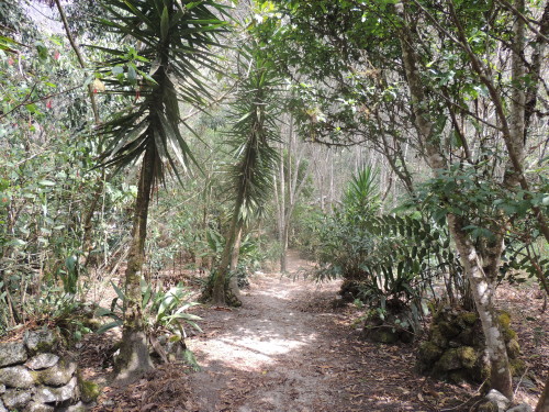
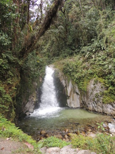
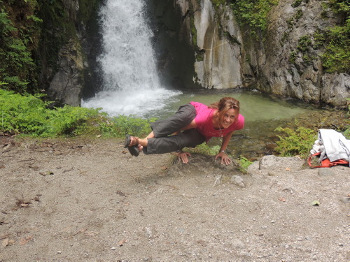
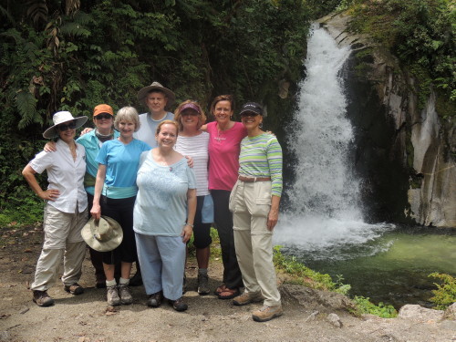
Originally settled by a few farm families in 1901, this area was transformed into a busy railroad worker's camp, called Maquinachayoq, during the construction of the railroad through the town in the late 1920's. The camp became the headquarters for the railroad's operations and lodging for workers until the railway was finished in 1931. Tourism is the mainstay of the economy these days. It was renamed to Aguas Calientes after its sulphur springs thermal pools. More recently, it was renamed again to Machu Picchu Pueblo to give it a more commercial appeal. Today, the town is known for its thermal baths, pubs, pizzerias, restaurants, hostels, hotels, colorful markets and nearby waterfalls. I choose to trek with a small group to the Mandor Gardens and Waterfalls. The trail follows the railway tracks for 5 km (3 mi), parallel to the course of the Urubamba River. After the four hour hike and a late lunch at Toto's House, it was back to El Mapi Hotel for a Pisco sour cocktail, a creamy, frothy, limey drink that packed a welcomed punch.
Accommodations: El Mapi Hotel; Tasty Dining: Toto's House; El Mapi Hotel
Click on image for slideshow and captions
Machu Picchu
 From Aguas Calientes, I caught one of the frequent bus shuttles to Machu Picchu. Seated next to me on the bus was Elena, a young Quechua Indian. Turns out she works as a guide at Machu Picchu. We shared stories about our lives, similar in so many ways yet worlds apart. The bus took about 30 minutes to wind its way up the 8 km (5 mi) of switchback road to the ruins. Upon our arrival the site was already crowded with tourists. One touristy thing I did was get my passport stamped with the official Machu Picchu stamp. Help the local economy and hire a top-notch guide when you visit Machu Picchu. Having a good guide is the key to navigating the site. Admission lasts just one day and there is a lot to see and learn.
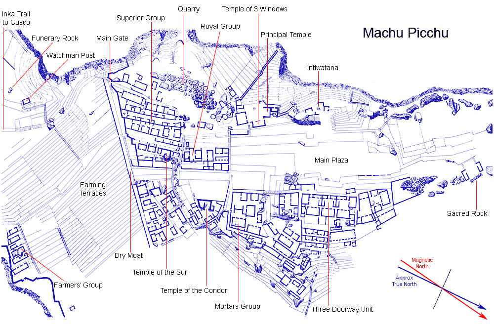
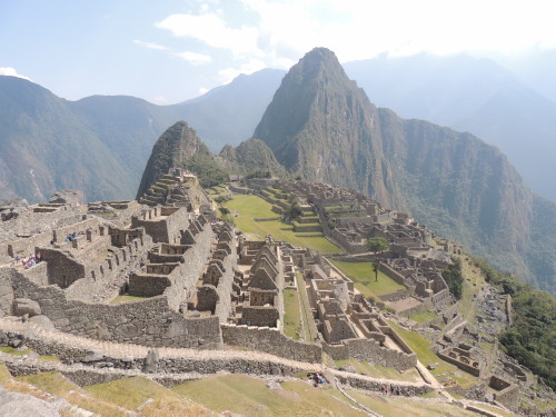
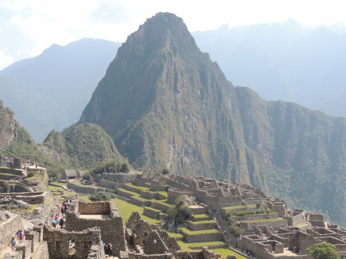
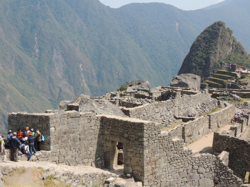
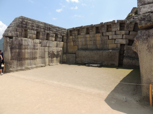
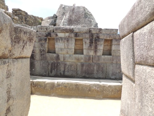
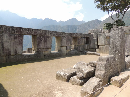
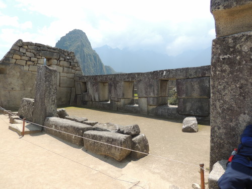
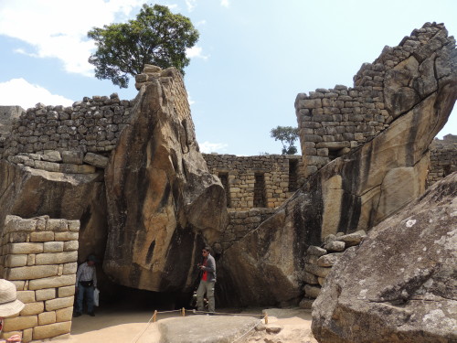
Machu Picchu, an incredible masterpiece of Inca architecture, is a spectacular site and spiritual place. Archeologist believe it to have been built during the first half of the 15th century, during the reign of Inca King Pachacuti, though aren't sure what is was for. The Inca had no written language, so they left no record as to why they built the site or how they used it before abandoning it in the early 16th century. The complex of palaces and plazas, temples and homes may have been built as a royal estate of an Inca king, retreat for ruling elites, ceremonial site, or a military stronghold. It is called a sacred city, sanctuary or citadel because supposedly only the Inca (king) and chosen members of his entourage had access to it.
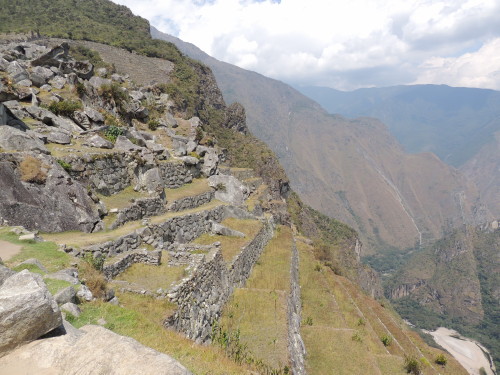
Machu Picchu is set in a rugged geographical area in the Peruvian jungle. It is tucked on a mountainous ridge between two towering mountain peaks, the Huayna Picchu and the Machu Picchu, in the Vilcanota mountain range and surrounded on three sides by the gorges of the Urubamba River. The expansiveness of the place is astounding, and the longer you're here the more you come to appreciate it. Perched nearly 2,500 m (some 8,000 ft) in the clouds, it is a place with seemingly endless terracing stretching down 487 m (1,600 ft) to the Urubamba. Covering an area of 32,592 ha (80,536 ac), Machu Picchu is cited as one of the world's wonders and was declared a Peruvian Historical Sanctuary and UNESCO World Heritage Site in 1981 and 1983, respectively.
Machu Picchu's architectural footprint, and the orientation of its temples, was influenced by what the Inca considered to be the sacred geography of the site. The site’s important features were laid out in alignment with nearby mountains and their resident gods (apus). Surrounding sacred mountains include Huayna Picchu, Yanantin, Putucusi, Machu Picchu, Salcantay and Veronica.
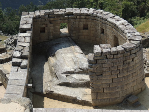
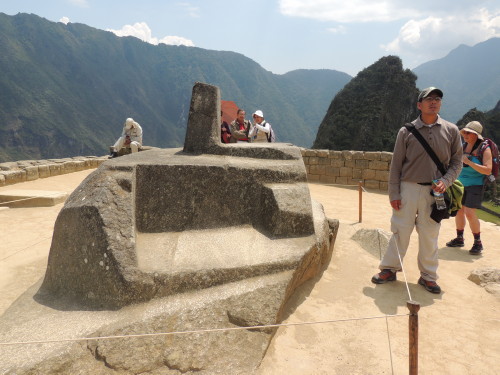
The Intihuatana, a highly sacred rock (huaca), sits on one of Machu Picchu’s highest points. It is located on a hill cut and reframed by several terraces. Intihuatana is crowned by a quadrangular pillar, sculpted from the mother granite rock, whose four corners are oriented toward the four cardinal directions. The rising and setting sun is visible from all points of the compass here on the upper platform of the terracing. Two of the most revered apus aligned with Intihuatana are Salkantay, located directly south, and Veronica, to the east. Intihuatana was a shrine used for specific purposes: it measured time by charting the rising of the sun during the summer and winter solstices, as well as at the equinoxes, was used for astronomical/celestial observations, and also served as an altar for worshipping the sun, the supreme natural god.
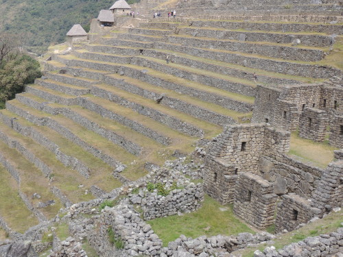
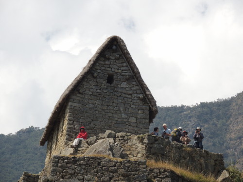
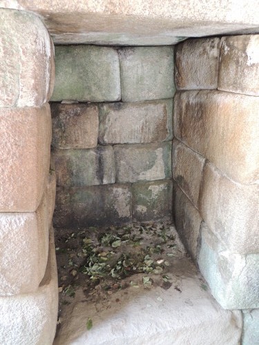
Machu Picchu features about 200 stone structures and scientists speculate it was probably inhabited by no more than 750 people. It is divided into two sectors, the agricultural sector to the south and the urban sector to the north. The farming sector consists of terraces or andenes, supported by carved stone walls, where the Inca grew their crops. These terraces also provided protection from runoff and hillside erosion. The terraces are linked by a network of canals and aqueducts through which irrigation water was channeled. Food storage facilities and the houses formerly occupied by the caretakers of this area are situated beside the terraces.
The urban sector is divided into the urban, religious, economic and military zones, in which there are corresponding squares, palaces, temples, dwellings and burial grounds. The urban area is composed of some 170 buildings connected by over 100 stairways. The Main Plaza is a large grassy area between the eastern and western sides of this sector.
Click on image for slideshow and captions


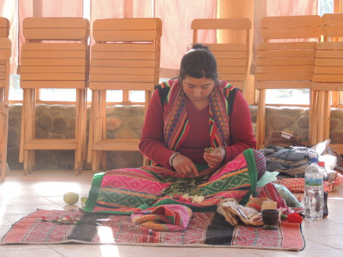
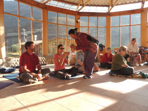
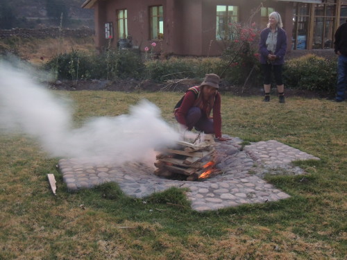
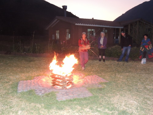
Pisac
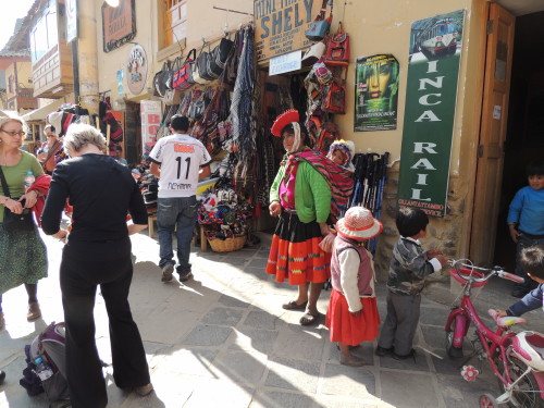
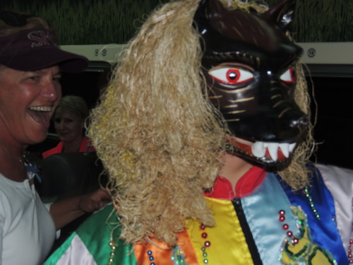
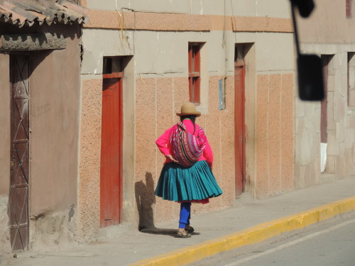
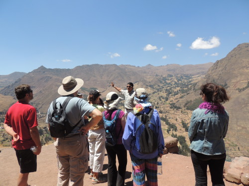
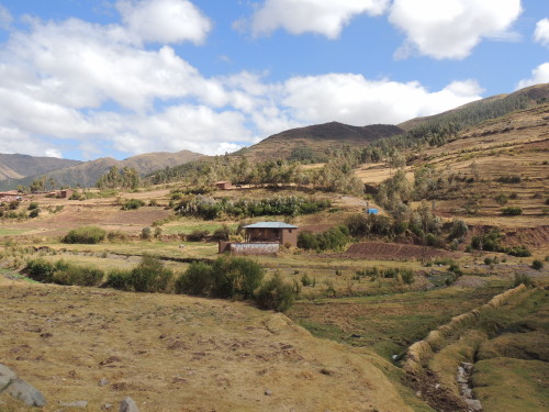
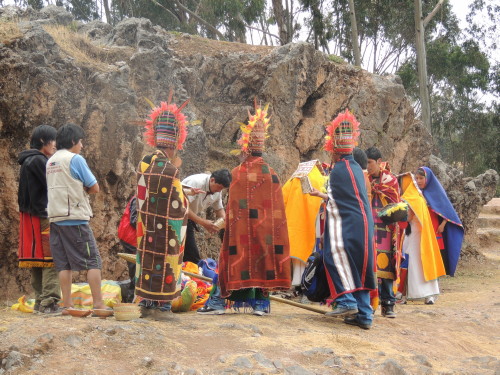
Pisac is a quaint Andean town at the eastern end of the Sacred Valley and located 32 km (19 mi) northeast from Cusco. The highlights of my stay here were participating in a shaman ceremony and visiting the Inca ruins and the colorful market. Pisac was founded by the Spanish conquistador Viceroy Toledo about 40 years after the Spanish conquest of Peru. It has evolved into one of the biggest and well-known artisanal markets in Peru. In the town's main square, hand-crafted goods including weavings, arpilliras, alpaca sweaters, ponchos and hats, carved gourds and pan pipes (zampoña) and other traditional Andean musical instruments, touristy trinkets, local produce and cooked Andean foods are sold every day. I loaded my pockets with Peruvian nuevo soles; in the tourist areas, it is customary to pay one nuevo sol (38 cents USD) to take a picture of a villager decked out in traditional dress. This is how some locals make a living.
Click on image for slideshow and captions


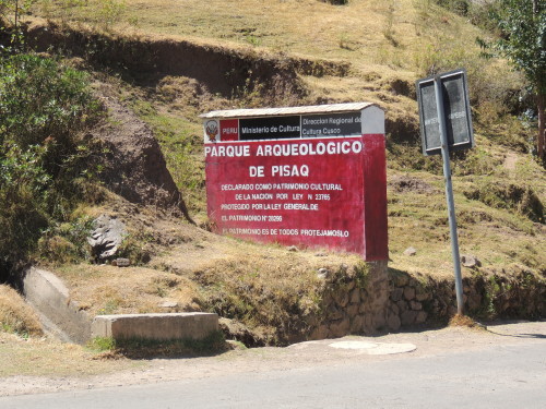
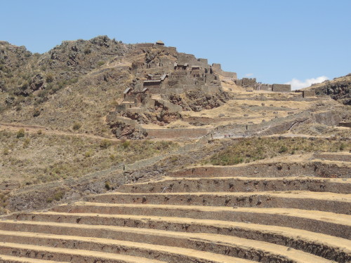
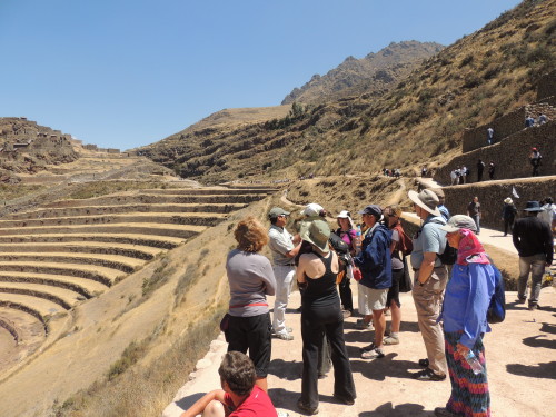
Pisac Ruins
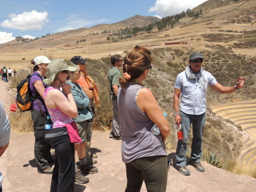
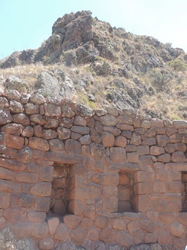
The Pisac Ruins lie on top of a mountain overlooking the city. Along with those at Machu Picchu and Ollantaytambo, they represent the great Inca ruins in the Sacred Valley. During Inca times historians believe that the Pisac ruins served as an important spiritual and agricultural site for the Incas as well as a strategic military outpost to protect the southern entrance to the Sacred Valley. The ruins feature various types of Inca architecture: agricultural, hydraulic, residential, religious and military. Andean terraces, fortresses, residential areas, ritual baths, cemeteries and temples all make up for a sight to behold.
Click on image for slideshow and captions


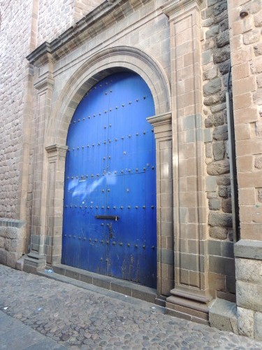
Cusco
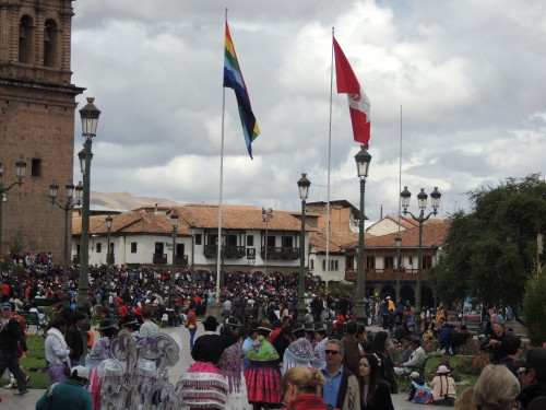
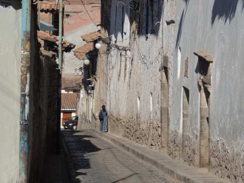
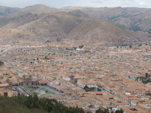
The Andean city of Cusco (Qosq’o in the Quechua language) lies 3,400 m (11,150 ft) above sea level in the Huatanay River Valley of Peru’s southeastern Andes. Today, some 400,000 people call Cusco home. Cusco was the capital of the Inca Empire of "Tahuantinsuyo" or "land of four quarters”. Two recent titles of distinction include being designated a World Heritage Site in 1983 by UNESCO and the Historical Capital of Peru by the Constitution of Peru in 1993. As capital of the Inca Empire, Cusco was the center of Inca religious and political power, home of its leaders and an important agricultural region. Today, Cusco is a major tourist destination, receiving some 2 million visitors a year.
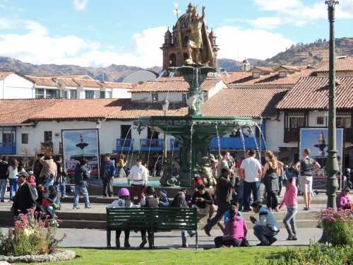
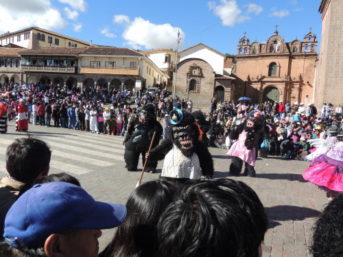
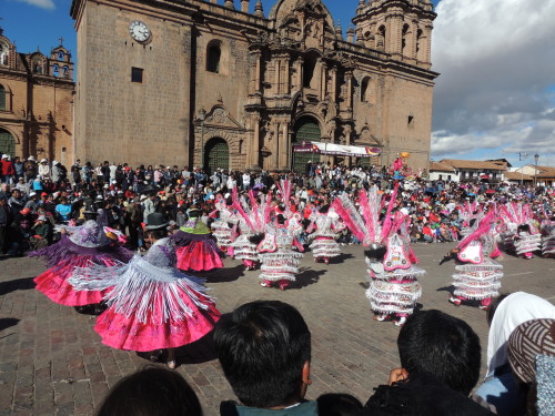
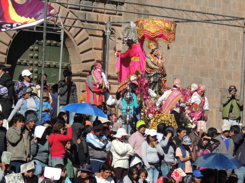
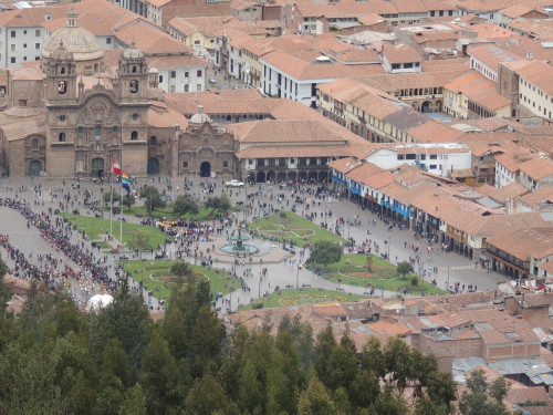
Within the city I visited the Plaza de Armas, Cusco's main square, and Qorikancha Santo Domingo. The main plaza in all Peruvian cities is called the Plaza de Armas. Cusco's is busy day and night. A huge 16th century cathedral and other ornate churches dominate the square and numerous cafes, restaurants and stores spill out into it. The Plaza is used for most of the city’s special events, festivals and demonstrations. Two flags fly over the square, the red-and-white flag of Peru and the rainbow-colored flag of the Inca nation.
Cusco's Plaza was called Huakaypata during the Inca Empire. It was a colossal plaza and served as the cultural center of Inca life. The city of Cusco was designed in the shape of a puma in profile. The Plaza was intentionally built at the center of the city, at the location of the heart of the puma. In 1532 Francisco Pizarro took control of Cusco, renaming the Plaza to Plaza de Armas.
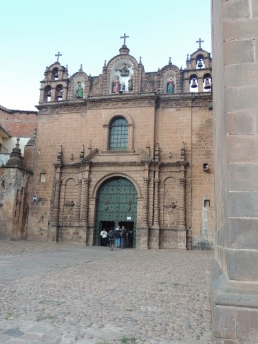
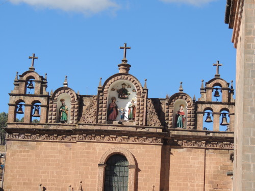
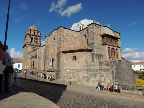
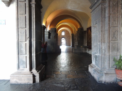
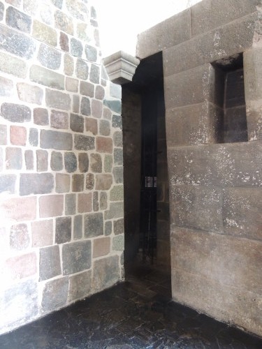
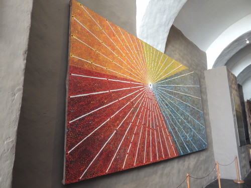
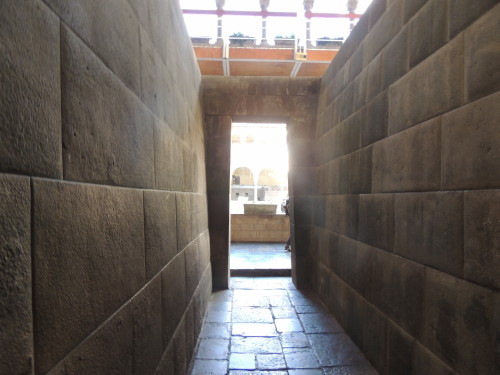
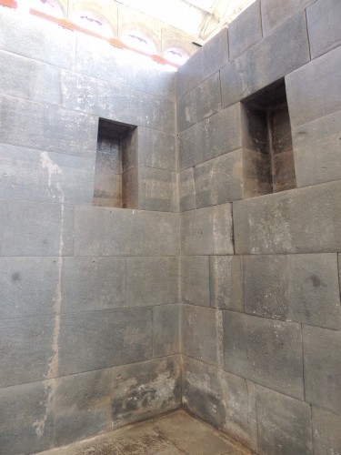
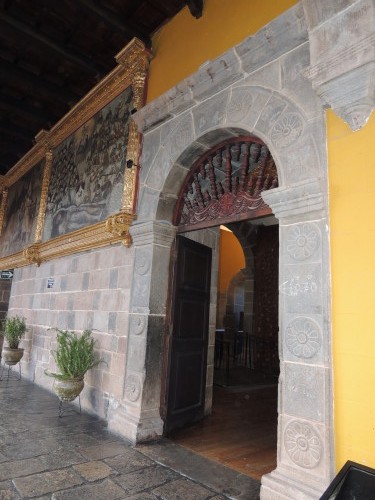
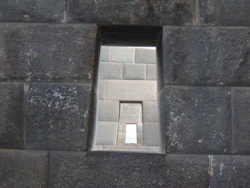
The Qorikancha, from the Quechua words Quri Kancha meaning Gold Courtyard, was one of the most sacred temples in the Inca Empire. It was dedicated primarily to Inti, the Sun God, though there were also temple rooms dedicated to related divinities including the moon, stars, constellations, planets, lightening, thunder and rainbow. The temple rooms were located around a large central courtyard with a fountain in the center. Like other Inca ceremonial structures, the temple also served as a solar observatory and mummy repository.
The exterior and interior walls and the floors of Qorikancha were once covered with thick plates of solid gold, and its courtyard was filled with golden statues. The Inca revered the Sun God and associated gold with the solar spirit. Gold was appreciated by the Inca for its beauty, resistance to corrosion and workability, not its value. They wanted Qorikancha to be as splendid as the sun. Spanish reports tell of Qorikancha’s splendor as being "fabulous beyond belief".
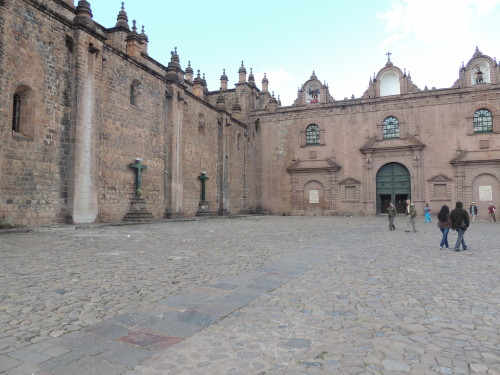
The Spaniards took over the Qorikancha and built a Dominican church and convent of Santo Domingo on the site, demolishing the temple and using its foundations for the church. Construction took most of a century. For centuries, many of the Qorikancha walls were hidden beneath the convent. A devastating earthquake shook Cusco in 1950 causing large sections of the convent to crumble and exposing the original Inca walls of Qorikancha.
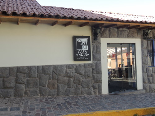
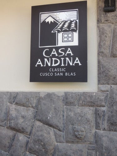
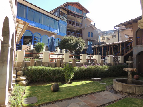
Accommodations: Casa Andina, located in the artesan barrio of San Blas; Tasty dining: Inka Grill, centrally located facing the Plaza de Armas and Green's Organic, located in the San Blas barrio
Click on image for slideshow and captions


Cusco Ruins
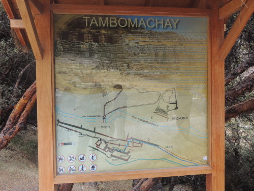
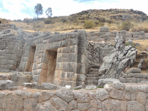
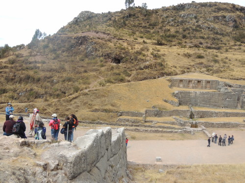
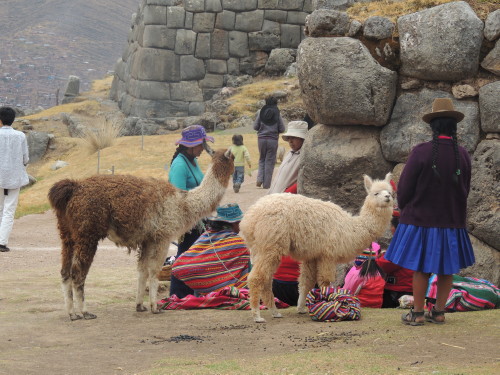
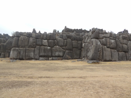
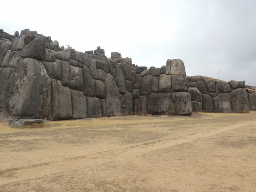
Three Inca sites on the outskirts of Cusco that we visited include Tambomachay, Qenqo, and Sacsayhuamán.
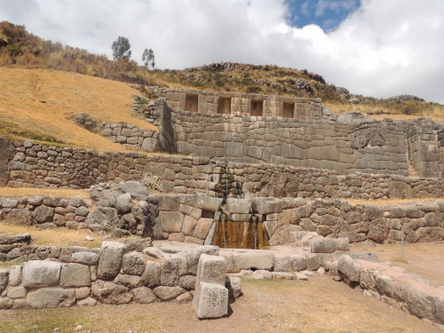
Tambomachay or "Bath of the Incas" consists of a series of aqueducts, canals and waterfalls that run through three tiered platforms. It is not known how the Inca used the site. It may have been a site for ritual bathing for the Inca nobility and/or a military and communication outpost guarding the approaches to Cusco.
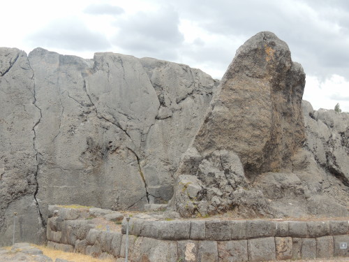
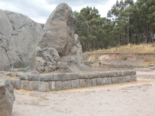
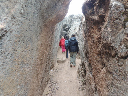
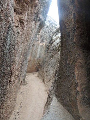
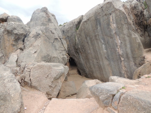
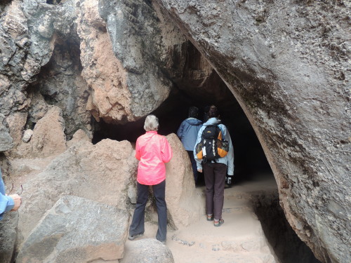
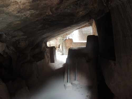
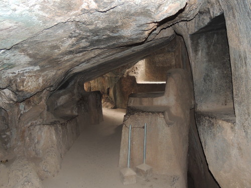
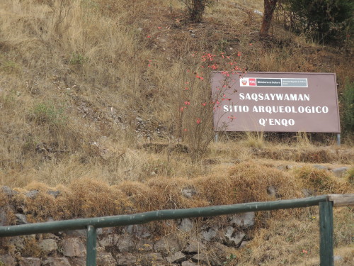
Qenqo is one of the largest huacas (holy places) in the Cusco region. It is a unique temple in its construction, having been entirely carved out of a gigantic monolith. Many huacas were based on naturally occurring rock formations. In Quechua, Qenqo means labyrinth or zigzag and the temple is named for the serpentine canal cut out of its rock. How the Inca used the site is unknown. Researchers speculate Qenqo was a temple where death rituals took place.
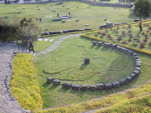
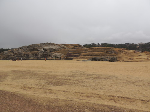
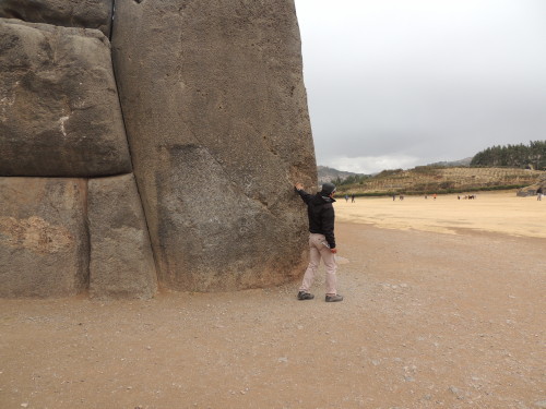
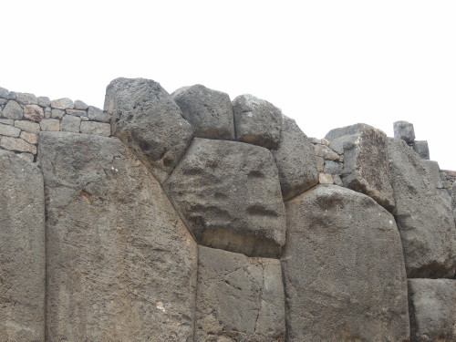
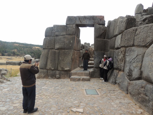
Identified as a temple, ceremonial center, imperial residence, astronomical observatory and a fortress, Sacsayhuamán was built overlooking Cusco on top of a mountain where tradition says the guardian spirits of the Inca lived. It was built to showcase Inca power and majesty. This archeological treasure is formed by three massive, parallel stone walls zigzagging together for some 600m (1,968 ft) across the plateau just over the other side of the mountain top from Cusco city and the valley below. The complex is made of the most monumental and gargantuan stones precisely configured, sculpted and carved to fit together tightly without mortar. Some stones are up to 20 ft high and weigh nearly 200 tons. Many of the stones used to construct the walls were designed in such a way that their interlocking shapes formed figures representing animals, plants and people. Following the siege of Cusco, in an act of domination, the Spaniards used Sacsayhuamán as a source of stones for building Spanish Cusco and within a few years the complex was virtually demolished. Today, only the largest stones remain at the site.
Scroll to the bottom of the page for pictures.
Cusco History:
Lake Titicaca is the birthplace of the Inca civilization (1100 AD) while Cusco, founded by the first Inca King Manco Capac and Mama Occlo around 1200 AD, is the birthplace of the powerful Inca Empire (1300-1500 AD) known by the Incas as “Tahuantinsuyo” or “land of four quarters” because of the way the land was divided into four suyos or administrative regions. The four suyos were: Chinchasuyo (North), Antisuyo (East; the Amazon), Collasuyo (South) and Contisuyo (West).
The Inca Empire stretched north to south some 2,500 miles along the Andean mountain ranges from Colombia to Chile and reached west to east from the Atacama dry coastal desert to the Amazon rainforest. At the height of its reign the Inca Empire was the largest nation on Earth with an estimated population of between 12 and 15 million people and remains the largest native state to have existed in the western hemisphere. Cusco (Quechua: Qosq'o) was the capital of the Inca Empire, center of Inca religious and political power and home of its leaders.
Pachakutiq, the ninth Inca leader (1438-1470), is credited with building the Cusco area and constructing nearly all the major Inca monuments nearby including Pisac, Ollantaytambo, and Machu Picchu. He designed the Cusco area into the shape of a puma, a sacred animal, in profile: Sacsayhuamán is the head; the heart of the puma was Huakaypata, a ceremonial square in the city of Cusco; Qorikancha, the sun temple, the side; the tail, Pumachupan (lower part of Cusco), is formed by the junction of the city's two main rivers (Huatanay and Tullumayo).
Cusco was unrivalled by any other South American city by the time the Spanish conquistadors invaded Peru in 1532. It had magnificent stonework architecture and abundant wealth in the form of gold and silver. In 1533, the Spanish invaded Cusco. Soon after, they brutally defeated the Inca. Throughout years of conflict and Spanish colonization Inca lost their lives in battle and to smallpox, brought to South America by the Spanish. What remains of the Inca legacy is limited, as the conquistadors plundered what they could of Inca treasures and tore down structures built by the Inca. In an act of domination, the Spanish destroyed plazas, buildings, temples and royal palaces, confiscating and melting into bars the gold and silver for shipping to Spain. They used the remaining massive stone walls built by the Inca as foundations for the construction of colonial buildings. The construction of the Spanish Convent of Santo Domingo directly over Qorikancha is an example. Likewise, the Huakaypata was converted into the Plaza de Armas with the Cathedral constructed to dominate the colonial square. Cusco became the center for the Spanish colonization and spread of Christianity in the Andean world.
Peruvian independence was first declared in 1821 but it was not until 1823 that it gained absolute independence. The Cusco region's archeological importance first gained renown after the excavation of Machu Picchu in 1911 by Hiram Bingham. The 'discovery' of Machu Picchu transformed Cusco from a remote colonial city in the Andes into one of Peru’s leading tourist destinations.
Click on image for slideshow and captions


Continue to Amazon Rainforest >>